Where are the Single People in Philadelphia?
Based on the Census data from 2010 to 2016
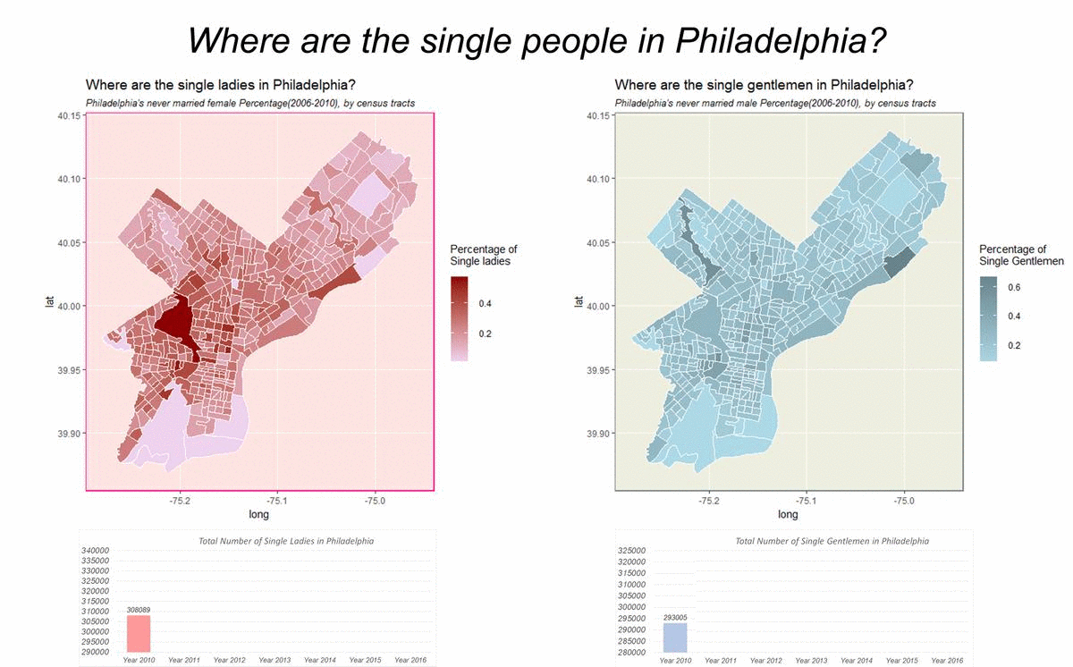
There are multiple reasons for creating this map. People usually believe the single females are in the places where there are high income and less rural areas, however, this map shows that north Philadelphia is the place always with the highest percentage of single ladies, and the dynamic of the trend is single female tend to spread out from clustered spaces, like central city and west Philadelphia, out into the entire cities. Besides, the number of single ladies is stably increasing throughout the years. Many economists believe the number of single women is related to the job market. So the reason might be the large job market in the US is making more and more female financially independent, and making marriage less of an economic necessity. Therefore, from this map, it is possible that between 2010 and 2016, the economic condition is becoming better and better, thus there are more single ladies working rather than getting married in Philadelphia.
In comparison, there is also a map showing where the single gentlemen located in Philadelphia. Although the number is also stably increasing throughout the years, the location of the high percentage of the unmarried male seems to be clustered in south Philadelphia and some of the places in northeast Philadelphia. And their cluster spaces seem to be more stable throughout the time. Putting these two maps together, we can see that in Philadelphia, it is getting harder and harder for single gentlemen to meet single ladies.
The creation of this map took three steps. The first step is to load the raw data of sex and marital status data downloaded from the Census ACS Survey. After selecting the useful data and cleaning the null values, the census data with only single people are ready to be joined with the shapefile of census tracts. The second step is to load the shapefile of Philadelphia Census tracts and join it together with the number of single people data by census tracts’ IDs. The last step is to create a bar chart of the number of single people throughout the years. By combing these images into one GIF, the final map of “Where are the single people in Philadelphia from 2010 to 2016” is finished.